
by Dr. Lenore Tedesco, Executive Director
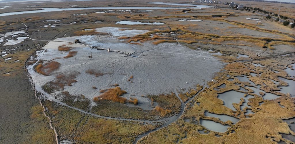
Drone image of newly placed sediment at Scotch Bonnet
The project goal is to restore lost marsh by elevating the marsh surface and reestablishing the appropriate balance with life-giving tides. Sediment came from navigation channel maintenance by our project partner, the US Army Corps of Engineers (USACE), and was tested and confirmed to be free of contaminants.
In early October, field crews from Barnegat Bay Dredging Co. placed biodegradable coconut fiber “logs” on the marsh to create zones to help settle out the sand and mud and build elevation where it was needed most. Other teams from the USACE constructed barriers in the tidal channel to encourage sediment flows to settle on the marsh surface. Numerous collaborating scientists and engineers installed monitoring systems to study the marsh’s response to the placement.
Dredging and placement operations began in mid-October and finished in early December. The muddy slurry was pumped nearly 2 miles though a floating pipeline and sprayed on Scotch Bonnet Island marsh in the Cape May Coastal Wetlands Wildlife Management Area managed by project partner NJDEP.
At the end of the placement, a mini dozer was brought in to grade the surface to the established target elevations. Currently, the marsh elevation is between 4’ and 2’ NAVD88, slightly higher than we expect it to be when the site settles out. In total 14,000 cubic yards of sand and mud were placed, covering an area of 5.5 acres; in many places, the deposit is more than 3’ thick.
Sediment placement covered the marsh grasses, but inspection of the new surface shows that a lot of seed has already washed in, setting the stage for natural marsh grass colonization as we have seen at other restoration sites.
We have already observed wildlife benefits as large numbers of shorebirds and gulls frequented the site looking for tasty morsels transported with the sediments. The high marsh area immediately became a safe haven for birds; in high-water events this winter, we saw impressive numbers of shorebirds resting and foraging on the mud flats, especially when the surrounding marsh was flooded. The project even attracted a rare American Golden-Plover that quickly became the star of the placement, drawing birding enthusiasts eager to catch a glimpse.
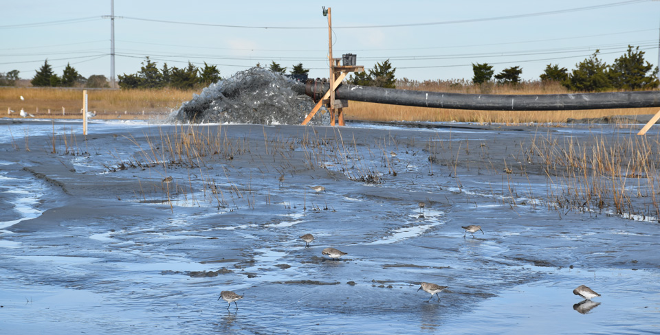
Shorebirds feeding during active placement
The benefits of this project extend beyond Scotch Bonnet Island. Lessons and know-how are already informing other projects and contributing to scaling-up efforts to help build resilience into our marshes.
For more information, visit the project website. A timelapse video of the project is at this link.