
by Julie Blum, Research Scientist
Salt marshes are highly dynamic environments, and understanding how they change over time is an important element of marsh research. To monitor these changes, our research team collects spatial data through a combination of on-the-ground surveying and remote sensing techniques. We then use mapping software to visualize and analyze that data and gain new perspective on marsh vegetation, elevation, and wildlife.
Using high-accuracy GPS equipment, we can collect elevation data at any point on the surface of the marsh. Later, those points are averaged to estimate the elevations in between. By getting a sense of overall marsh height and elevation variation, we can better understand patterns of vegetation growth and how these factors may impact marsh species.
In collaboration with the University of Pennsylvania (UPenn), we are collecting high-resolution drone images showing the location of marsh pools, mudflats, and particular plant types. When comparing drone images across years, we can estimate whether these features are growing or shrinking, and what that could mean for the wildlife species that rely on each habitat. In partnership with New Jersey Fish and Wildlife, we can also use these images in conjunction with aerial surveys to count wading birds and estimate the number of nests.
Since certain details are not always clear when relying on imagery analysis alone, we combine it with on-the-ground data collection. Recording the boundaries between plant communities with GPS creates lines that we compare and overlay with drone images. We also establish consistent locations for vegetation surveys and photo records that show change at a finer scale. By viewing marsh dynamics through multiple lenses, we can form a better understanding of both localized change and the landscape as a whole.
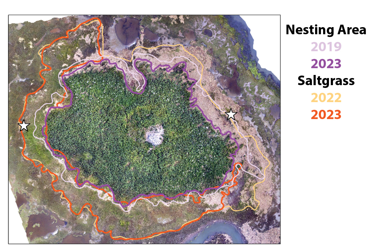
Changing plant community boundaries at a wading bird colony collected on the ground using GPS. Photo monitoring locations are starred. Drone imagery captured by UPenn, 2023.